Land Use and Land Cover Classification with Sentinel-3
Applied foundation models to streamline land use classification. Demonstrated gains in classification accuracy and training efficiency.
Training data
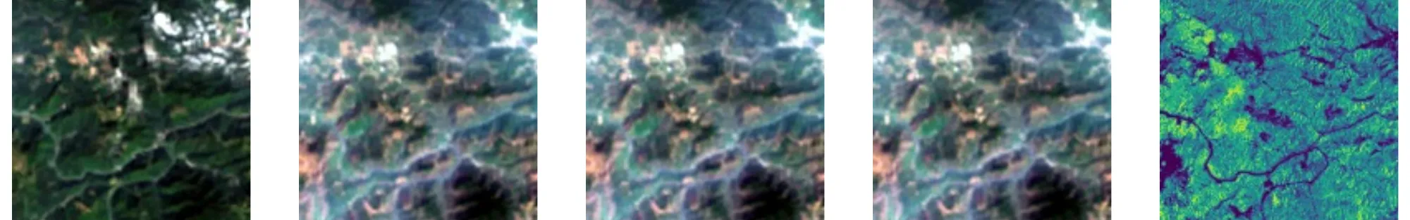
The spotlight application uses two custom datasets built from Sentinel-3 OLCI imagery and the Copernicus Global Land Service LC100 product (CGLS-LC100), a global land cover map at 100m resolution with 23 classes.
-
LC100Seg-S3: A semantic segmentation dataset.
-
LC100Cls-S3: A multilabel classification dataset.
Data was sampled from 10,000 locations worldwide using Google Earth Engine. Each sample includes:
-
One CGLS-LC100 land cover map (288×288 pixels)
-
A time series of up to four Sentinel-3 OLCI seasonal images (96×96 pixels, 300m resolution)
Clouds were filtered using a model trained on the Cloud-S3 dataset. After cleaning, about 8,000 high-quality samples remained.
The datasets are split into 5,181 training, 1,727 validation, and 1,727 test samples using both random and geographical splits.
For benchmarking, both static (single image) and time-series versions of the dataset are supported.
Link to main concept
-
Copernicus Foundation Models: Used as feature encoders for both classification and segmentation tasks, evaluated in comparison to models like DOFA and supervised baselines.
-
In-domain pretraining: The Copernicus-FM model, pretrained on Sentinel-3 imagery, showed superior performance over generic foundation models and even outperformed fully supervised models.
-
Multi-task downstream learning: Demonstrates transferability of pretrained representations across classification and segmentation tasks in Earth observation.
Impact
This application shows the value of domain-specific pretraining for land use and land cover classification. The Copernicus-FM model achieved higher accuracy than both supervised and other pretrained approaches, confirming that foundation models trained on relevant EO modalities can provide robust, transferable features. This paves the way for scalable land monitoring systems that require less labelled data and are resilient to environmental variability, supporting planning, conservation, and resource management worldwide.
