Flood Mapping with Sentinel-1
Enhanced flood detection using pretrained Copernicus foundation models on SAR imagery. Results show improved accuracy and faster processing.
Training data
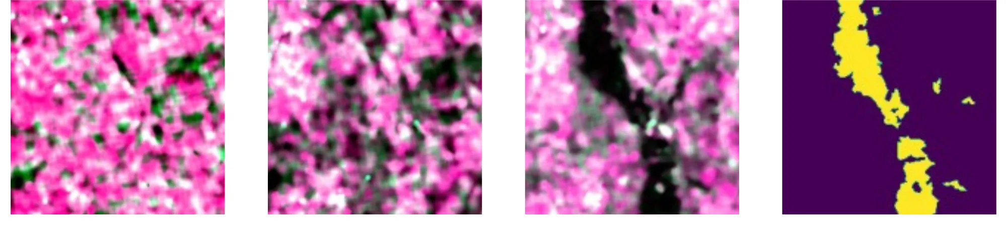
The application is based on Flood-S1, a curated dataset derived from the large-scale Kuro Siwo collection. It includes manually annotated flood events from across the globe, with pixel-level segmentation labels for three classes: non-water, water, and flood. Each sample includes two pre-event and one post-event Sentinel-1 SAR GRD images (dual-polarisation), formatted as 224×224 image patches for time-series segmentation or change detection tasks.
Two evaluation strategies are used:
-
Random split: samples containing water are randomly divided into training (3000), validation (1000), and test (1000) sets.
-
Geographical split: training, validation, and test sets come from distinct regions, allowing evaluation of spatial generalisation.
Data is visualised using false-colour combinations of VV, VH, and their average.
Link to main concept
- Copernicus Foundation Models (FM): Used as frozen backbones in change detection architectures (e.g. ViT-based encoders with UPerNet decoders), enabling evaluation of pretrained vs. supervised performance.
- Model benchmarking: Compared supervised models with foundation models such as SoftCon, CROMA, DOFA, and the emerging Copernicus-FM. Evaluations are based on mean Intersection over Union (mIoU).
- Low-label regime + temporal dynamics: The setup simulates real disaster response conditions with limited training data and strong temporal context (pre/post-event).
Impact
This application validates that pretrained foundation models can match or exceed supervised performance in flood segmentation, with fewer trainable parameters and better generalisation. The Copernicus-FM model—still under development—already shows promising results, outperforming other pretrained baselines. This confirms the potential of foundation models for real-time flood monitoring, offering both speed and robustness in critical emergency scenarios.
