ThinkingEarth for Solar Energy Applications
The study “Ray-Tracing modelling for urban photovoltaic energy planning and management” with contribution by ThinkingEarth Use Case One leader, Panagiotis Kosmopoulos, introduces a new way of radiative transfer modelling using Raytracing to address the challenges faced.
Challenges in PV installations
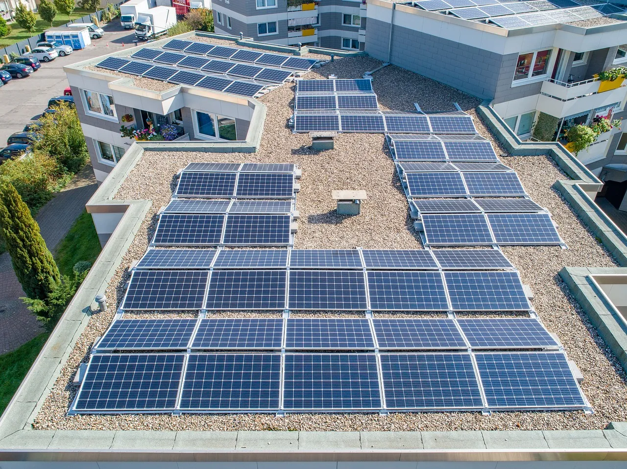
Rooftop solar energy is influenced by urban features, particularly the height and distance of neighbouring buildings, which create shadows that reduce energy conversion. The slope and aspect of the rooftop also significantly impact the energy output. Meteorological factors, like aerosols and clouds, further affect the radiation reaching the surface by absorbing and scattering light, thereby reducing solar panel efficiency.
The variation in solar radiation collected by PV systems depends on cloud coverage and thickness, as well as aerosol optical depth. Shadows from roof orientation, nearby structures, and atmospheric conditions alter the amount of solar radiation received.
Considering all these factors and incorporating them into the potential estimation process helps the planning of the solar energy production and it’s effective usage accordingly.
What is Raytracing?
Ray-Tracing is a technique used to simulate realistic light interactions and paths to gather accurate data. For PV systems, the energy captured by the panels depends on the amount and type of solar irradiation they receive, which varies due to environmental factors and shadows. Ray-Tracing is incorporated into radiative transfer modelling (RTM) to account for these interactions and determine the shadows cast on the panels by the surrounding environment.
How does ThinkingEarth contribute?
Digital Twins can play a crucial role in the correct urban planning of PV systems.
Through the development of the Copernicus Foundation Models and the Earth Graph Model, ThinkingEarth aims to enhance short-term solar energy forecasting for cities. This includes managing energy within smart grids using solar power predictions and residential demand data, monitoring urban biodiversity, evaluating forest carbon credits for financial institutions, and identifying the causes of food security issues.
These data-driven graphs will improve our ability to predict food shortages, making the World Food Programme’s efforts more effective.
Use Case One (UC1) focuses on “Energy communities: Distributed solar energy production forecasting and demand management.”
The expected outcomes for UC1 include:
- The first three-dimensional cloud motion vector (3DCMV) for improved accuracy.
- Realistic solar photovoltaic (PV) energy production estimates at the household level using shadow casting and ray tracing data, supported by NVIDIA.
- A smart grid application prototype for managing distributed solar energy supply and demand.
By utilising advanced technology and considering various sectors, ThinkingEarth’s UC1 supports the growth of solar energy communities and effective management of distributed solar energy operations.
Follow us!
To learn more about ThinkingEarth and stay up to date on the latest news, follow us on X and LinkedIn. You can also get updates directly to your inbox by signing up to our newsletter.
Get in touch with us directly here.
Read next
Climate Change Demands Smarter Environmental Intelligence
Predicting Wildfires with Causal AI

5 Ways ThinkingEarth Helps the Planet
